/ By The Thyolo House
Fort Lister Mulanje: A Nature Walk Through the Forgotten Gap
Where Fort Lister Mulanje Sits — and Why the Gap Matters
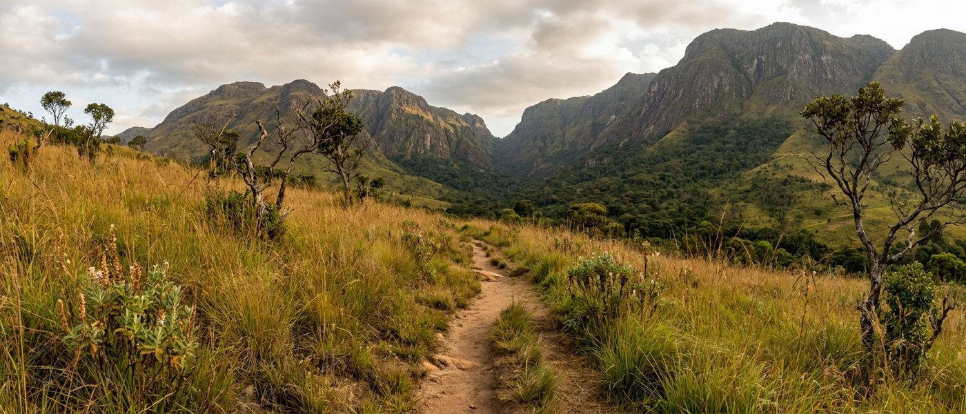
Fort Lister Mulanje is one of those places that most travel guides skip over in a single line, if they mention it at all. It sits on the north-eastern shoulder of the Mulanje Massif, in the saddle that geographers call the Fort Lister Gap — the natural break that separates the main Mulanje plateau from the smaller Mchese (or Michesi) Mountain to the north. From the road, the two halves of the massif rise like the wings of a great stone bird, and the gap is the quiet hinge between them.
The fort itself is in Phalombe District, about 44 kilometres by road north-east of Mulanje town. From The Thyolo House, our base on the Conforzi Tea Estate, it is roughly 90 minutes of driving — a journey that takes you past tea fields, smallholder villages, and the long flank of Michesi disappearing into cloud. For visitors who already know Likhubula, Chambe and the busy western trailheads, Fort Lister Mulanje feels like discovering a back door to a familiar building. The mountain is the same mountain. The mood is entirely different.
What makes the gap matter, ecologically and historically, is exactly that quietness. Fewer hikers means more birds along the path. Fewer vehicles means a slower pace at the trailhead. And the gap itself, sitting at a lower elevation than the main plateau escarpment, channels weather, wildlife and people through a narrow corridor of indigenous forest that has been left mostly to itself for the better part of a century.
A Short, Honest History of the Fort (1893 to the Forest That Reclaimed It)
The British established Fort Lister in the 1890s as a military administration post on the northern side of Mulanje. It was named for Sir Villiers Lister of the Foreign Office, and its job, in the language of the time, was to "police the slave routes" between the Lake Chilwa plains and the Mozambican border. In practice it was a small, hard-living garrison: a handful of officers, a contingent of African troops, a few stone buildings tucked into the gap, and a great deal of malaria.
The post was abandoned within a couple of decades. The administrative weight of the colony shifted west to Zomba and Blantyre, and Fort Lister, never quite strategic enough to justify the climb, was simply left. For a long stretch of the 20th century the buildings served as a forestry ranger station and a basic guesthouse for hikers crossing the plateau. Today even those have been given back to the forest. The original ranger station and guesthouse are abandoned. The fort, as one traveller noted dryly, "has no fort, incidentally."
What remains is the place itself: a name on the map, a clearing, a few weathered foundations under moss, and a track that climbs into the indigenous trees. It is one of the most honest pieces of colonial history you can visit in southern Malawi — not because anything has been preserved, but because the forest has been allowed to do what forests do.
What the inscription means for Fort Lister
In July 2025, UNESCO inscribed the Mount Mulanje Cultural Landscape as a World Heritage Site. The decision covers the entire massif, including the Fort Lister Gap, and recognises both the biological richness of the mountain and the cultural and spiritual significance it holds for the surrounding communities. In August 2025, senior traditional chiefs publicly affirmed their support for the listing — a quietly important gesture, given the long-standing tensions between conservation policy and customary land use in the area.
The inscription has not changed access at Fort Lister. The trail is still the trail. But it does mean that, for the first time, the obscurity of this corner of the mountain is matched by a piece of formal global protection.
The Walk Itself: What You'll See on the Path Through the Gap
The standard route from Fort Lister onto the plateau is the Sombani trail. It is the quickest plateau access on this side of the mountain — about three hours from the trailhead to Sombani Hut, climbing through moist evergreen forest before opening onto the rolling grassland of the upper plateau. Most day visitors to Fort Lister Mulanje never go that far. They walk for an hour or two into the gap, sit on a rock, eat a sandwich, and turn around. That is, in many ways, the right way to do it.
The first stretch is gentle. The path is shaded, soft underfoot, and crossed in places by small streams that run all year. You'll hear the water before you see it. Above you, the canopy is a mix of indigenous hardwoods — Newtonia, Khaya, Olea — and the air smells faintly of leaf mould and woodsmoke from the villages below. Butterflies move in the patches of light: emperors, swallowtails, the small electric blues that always seem to find a damp patch of sand.
About forty minutes in, the path steepens. This is where most casual walkers stop. Beyond it, the trail begins the climb to Sombani in earnest, and the forest gives way to montane scrub. If you are doing the Grand Traverse from the western side of the mountain, Fort Lister is the finish line: a three-hour downhill walk off the plateau, then a further two-hour stroll (or a motorbike taxi) along the gently descending main road into Phalombe.
Sombani Hut, if you want to stay overnight
For the small number of visitors who carry on to Sombani Hut, the reward is an unfussy mountain shelter: two rooms, one with bunk beds and a store room, the other with a fireplace, a table and a few chairs. Bookings are arranged through the Mulanje Mountain Conservation Trust office in Likhubula. The hut is rustic in the proper sense — bring your own bedding, food, and a head torch — but the silence at dusk, with the plateau folding into shadow around you, is one of the genuinely irreplaceable experiences in southern Malawi.
Birds, Butterflies and the Indigenous Forest Around Fort Lister
The forest belt around Fort Lister is one of the better birding patches on the eastern side of Mulanje, partly because the gap funnels species moving between the plateau and the lowlands. Cholo alethe, white-winged apalis, green-headed oriole, bar-throated apalis, and the more common but always welcome paradise flycatcher all turn up here. Early morning is best; by ten the canopy has gone quiet and you are mostly listening to wind.
For visitors interested in serious bird work, our birdwatching guide to Mount Mulanje covers the full set of plateau-edge endemics and where to find them. Fort Lister sits at the easier end of that spectrum: you don't need to climb to see good birds, you just need to be patient on the lower trail.
Butterflies deserve their own paragraph. Mulanje's invertebrate biodiversity is one of the things that the UNESCO inscription specifically calls out, and the Mulanje Mountain Conservation Trust is currently rolling out a programme of insect biodiversity research across the massif, including endemic species not yet formally described. Fort Lister, with its damp sand patches and broken canopy, is a fine place to watch them work the light without ever lifting binoculars.
The indigenous trees here include some of the same species under pressure elsewhere on Mulanje — particularly the critically endangered Mulanje cedar, which the MMCT's "Save Our Cedar" campaign is trying to protect. You will see the cedar higher up on the plateau rather than in the gap itself, but the ecological story is continuous: the gap forest is part of the same conservation envelope, and walking it quietly is its own small contribution.
Practical Notes — Getting There, Best Months, What to Pack
Phalombe town is the practical hub. From Blantyre or Limbe, drive south-east on the M2 toward Mulanje, then take the turning north-east via Migowi to Phalombe. From Phalombe, a marked road runs west toward the mountain and Fort Lister Gap. The last few kilometres are unsealed and rough in the rains; in the dry season, any 2WD car with reasonable clearance manages it. From The Thyolo House, the full drive is about 90 minutes.
Phalombe village, just before the trailhead, has very limited supplies — vegetables, basic snacks. Phalombe town itself is the proper transport and shopping hub: minibuses run from Limbe, and private taxis can be arranged. If you are coming as a day trip, buy water, snacks and lunch before you leave Thyolo or Mulanje town; do not rely on finding food at the trailhead.
Best months
- May to August — the cool dry hiking window. Crisp mornings, clear skies, low humidity. The best months for Fort Lister Mulanje without question.
- September and October — still dry but increasingly hot at lower elevations. Comfortable in the gap; sweaty at the road.
- November — first rains often arrive late November. Trails are still walkable but check the forecast.
- December to April — rainy season. Trails muddy, leeches present, river crossings sometimes impassable. We don't recommend Fort Lister in these months for casual walkers.
What to pack
- Proper walking shoes — the path is rooty, occasionally slippery
- 2 litres of water per person, minimum
- Sun hat and sunscreen for the road approach; light layers for the forest, which can be cool
- A light waterproof, even in the dry season
- Binoculars if you have them, for the birds
- A small offering of cash for the local guides who can sometimes be found at the trailhead — they are not formally rostered here as they are at Likhubula, but a willing escort makes the walk safer and shares the income with the village
Where to Stay Before and After: Thyolo House as Your Base
Fort Lister Mulanje is a day trip from very few places, and a comfortable one from fewer still. The town of Mulanje has serviceable lodges. Phalombe itself has almost nothing. The most considered approach is to stay in Thyolo, walk the gap as a long day, and come back to a proper meal and a quiet bed.
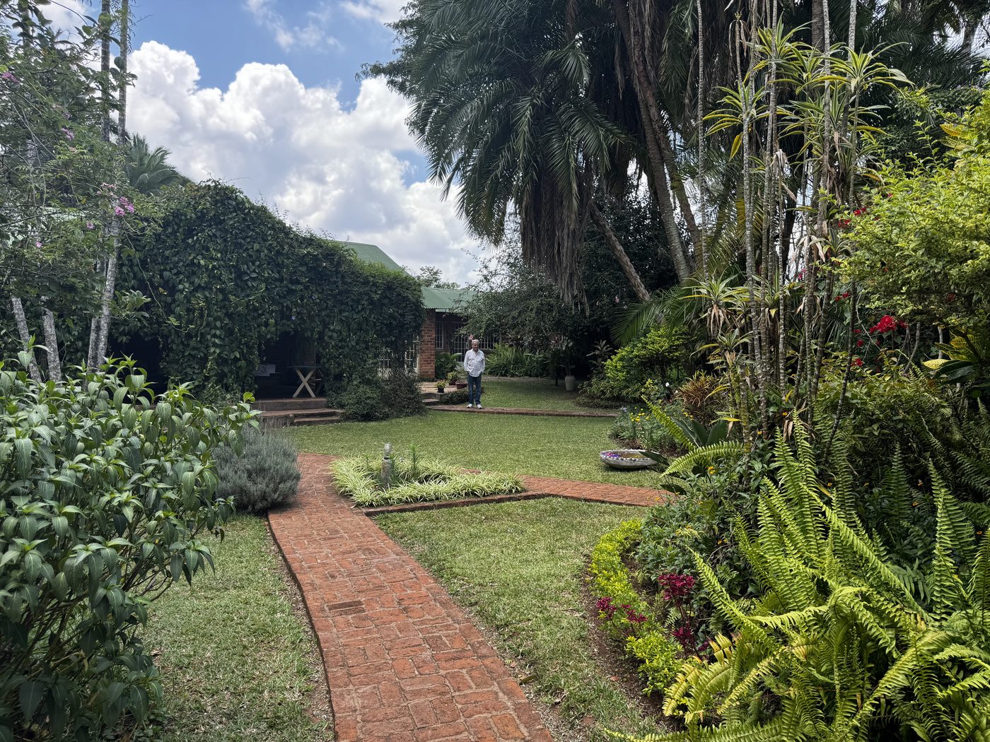
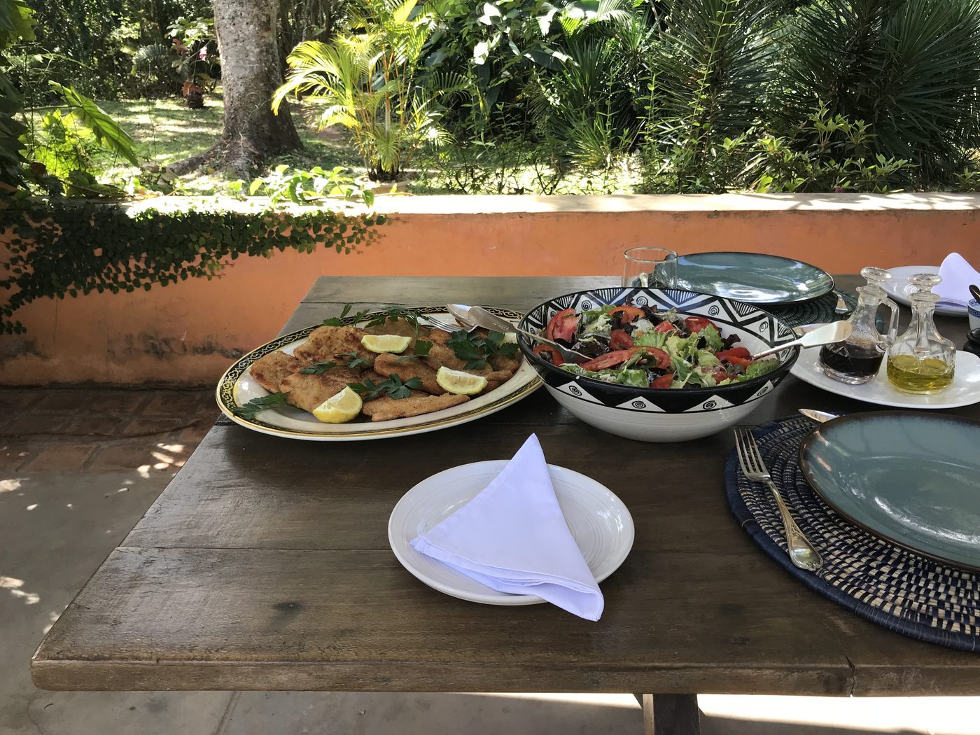
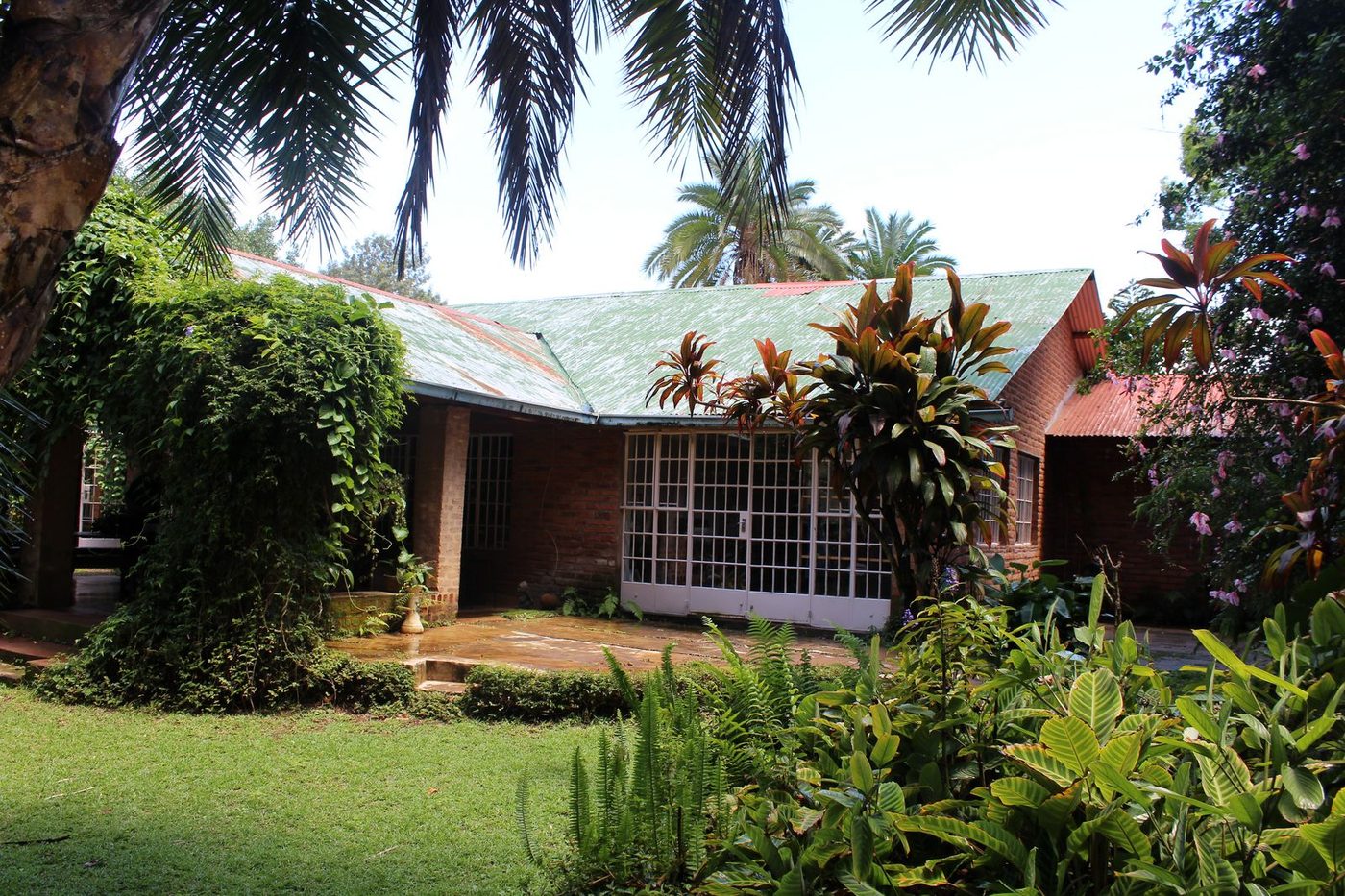
The Thyolo House is a five-room boutique hotel and restaurant on the historic Conforzi Tea Estate, run by the artist and tea-estate scion Flavia Conforzi. Twenty minutes from Limbe, forty from Blantyre, ninety from Fort Lister. The hotel sits inside the working tea estate, surrounded by indigenous forest trails of its own and a kitchen that uses what its garden grows — Italian fusion cooking with Malawian produce, the kind of food that is worth getting back to after a long walk.
Practically, that means you can leave Thyolo at seven, be at Fort Lister by eight-thirty, walk for three or four hours, drive back, and eat lunch on the verandah at two. Or you can stretch the day, take in Phalombe market on the way home, and time your return for sunset by the pool. We've put together a fuller piece on where to stay in Thyolo if you want to compare options before you book.
For art lovers, Flavia's studio is open to guests by arrangement; for tea lovers, the estate walks are some of the most beautiful in Malawi. Either way, having a fixed base 90 minutes from the trailhead means you don't have to organise lodging and meals around an obscure Phalombe road — you just drive, walk, and come home.
Pairing Fort Lister with Other Quiet Corners of Tea Country
Most travellers who come to Fort Lister Mulanje don't come for it alone. The walk through the gap is wonderful but short, and the surrounding region rewards a slower itinerary. A few suggestions for pairing it sensibly:
- Day one — arrive at The Thyolo House, a tea estate walk in the late afternoon, dinner on the verandah.
- Day two — Fort Lister day trip; back for a swim and a long dinner.
- Day three — a slower day. Indigenous forest trail on the estate, art workshop with Flavia, lunch in the garden.
- Day four — Mulanje town and Likhubula for a different face of the mountain, or a drive up to the Satemwa Estate for tea tasting.
For travellers building a wider Mulanje itinerary, our guide to Mulanje day trips covers Likhubula Falls, Mulanje town, Tinyade Falls and the Mulanje Mountain heritage routes. Fort Lister is the quiet end of that list. It is also, for many people, the most memorable.
One note on the bigger picture
It would be dishonest to write about Fort Lister in 2026 without mentioning the bauxite question. A company called Akatswiri Mineral Resources holds prospecting licences on the Lichenya and Linje plateaus on the south-eastern flank of the massif, and has proposed a roughly $820 million bauxite operation. The affected zones contain nearly half of the plant species endemic or near-endemic to Mulanje. Local chiefs, the Mulanje Mountain Conservation Trust, and a coalition of Malawian and international conservation NGOs are actively opposed; the campaign goes by "Hands Off Mulanje." The MMCT is meanwhile pushing forward with a 6.5-megawatt hydropower facility that, when complete, will electrify most of the villages around the mountain.
Fort Lister itself is on the north-eastern side of the massif and is not within the proposed mining footprint. But it is part of the same World Heritage landscape, and the future of the gap is bound up with the future of the wider mountain. Walking it, talking about it, and choosing operators and lodges that contribute to local livelihoods is not a small thing.
Booking and getting in touch
To plan a Fort Lister day from The Thyolo House — including driver, packed lunch from our kitchen, and a return time built around dinner — message us on WhatsApp or email thethyolohouse@gmail.com. Our five rooms book up quickly in the dry season (May through August in particular), so we'd suggest reaching out four to six weeks ahead if you have specific dates in mind. We're happy to talk through the walk, the road, the weather, and what to bring, and to put you in touch with a local guide on the Phalombe side if you want one.
Fort Lister is not a tick-box destination. There is no entry gate, no ticket booth, no signed loop trail. There is a forgotten name, a forest that has reclaimed its garrison, a path that climbs gently into the gap, and the long quiet weight of a mountain that has just been given the world's formal blessing. Come walk it slowly. Stay somewhere good afterwards. That is, in the end, what tea country is for.